Ella
Sri Lanka's hill-country traveller hub — the Nine Arches Bridge, the Ella Gap view, tea-terrace walks, and the end of the island's most famous train ride.
- Altitude
- 1,041 m
- Coordinates
- 6.867°, 81.047°
Current Weather
Ella is a single main street of guesthouses and cafés wedged into a gap in the southern escarpment of the hill country, and it is where most travellers in Sri Lanka end up spending a night more than they planned. The town itself is small. What surrounds it — viaducts, waterfalls, tea terraces, and a valley that drops 1,000 metres to the southern plains — is why it has become the island's most-photographed inland stop.
The Nine Arches Bridge
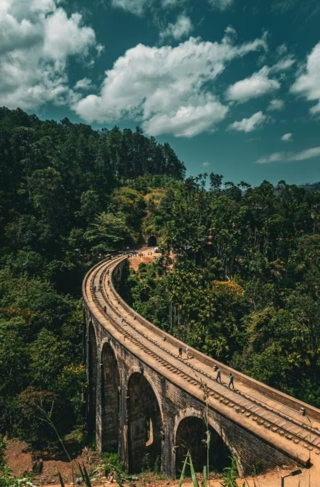
The Nine Arches Bridge stands in the forest between Ella and Demodara, a 91-metre stone-and-brick viaduct completed in 1921 on the Colombo–Badulla line. It carries the enduring story that it was built without steel because the First World War had diverted the girders elsewhere — an origin myth that may or may not survive scrutiny, but the bridge is unquestionably built of brick, cement, and stone rather than the ironwork used on comparable colonial viaducts.
Trains cross a handful of times a day. Locals and guesthouses know the schedule, and it is worth asking rather than guessing: the bridge is a twenty-minute walk down through tea and jungle from the Ella–Kital Ella road, and arriving five minutes after a crossing means an hour's wait. The Pekoe Trail's stage between Ella and the bridge is the walking route if you would rather earn the view than drive to it.
Ella Rock, Little Adam's Peak, and the Gap
Ella Rock is the bigger of the two classic walks — three to four hours return, following the railway line out of town before turning up through tea and eucalyptus to a cliff edge above the Ella Gap. It is easy to lose the path near the start; the route is unsigned and a guide or a downloaded track saves an hour of backtracking.
Little Adam's Peak is the easier counterpart: a gentle hour-and-a-bit through tea estate to a series of grassy knolls with a 360-degree view. Most people do it at sunrise, and it is genuinely accessible to anyone who can walk uphill for forty minutes.
The Ella Gap itself is the notch in the escarpment that the town looks through. On a clear evening you can see all the way to the southern coastal plain, and on some nights the lights of Hambantota.
Waterfalls and tea
Ravana Falls, on the road down towards Wellawaya, is the roadside cascade everyone stops at — full and dramatic in the wet months, thinner between June and September. Diyaluma, taller and further out towards Koslanda, is the bigger day trip.
Tea is the working landscape here. Estate factories around Ella and on the Bandarawela road run short tours that end, inevitably, in a tasting room. It is a low-key version of what Nuwara Eliya does at scale.
Getting here
Ella is the last stop worth stepping off at on the Kandy–Badulla railway, widely rated one of the world's great train journeys — roughly six to seven hours from Kandy, climbing through Nanu Oya and Haputale. Book reserved seats days ahead in season; second-class unreserved means standing in a doorway, which is either the highlight of the trip or a long afternoon depending on your temperament.
By road, Ella sits between the hill country and the southeast: about an hour to Wellawaya, from there onward to Arugam Bay or south towards the coast.